Raven Maps
Massachusetts, Connecticut, & Rhode Island [Physical, 32x36]
Massachusetts, Connecticut, & Rhode Island [Physical, 32x36]
Regular price
$50.00 USD
Regular price
Sale price
$50.00 USD
Unit price
per
Shipping calculated at checkout.
Couldn't load pickup availability
- SKU: RP_MA_WA_90
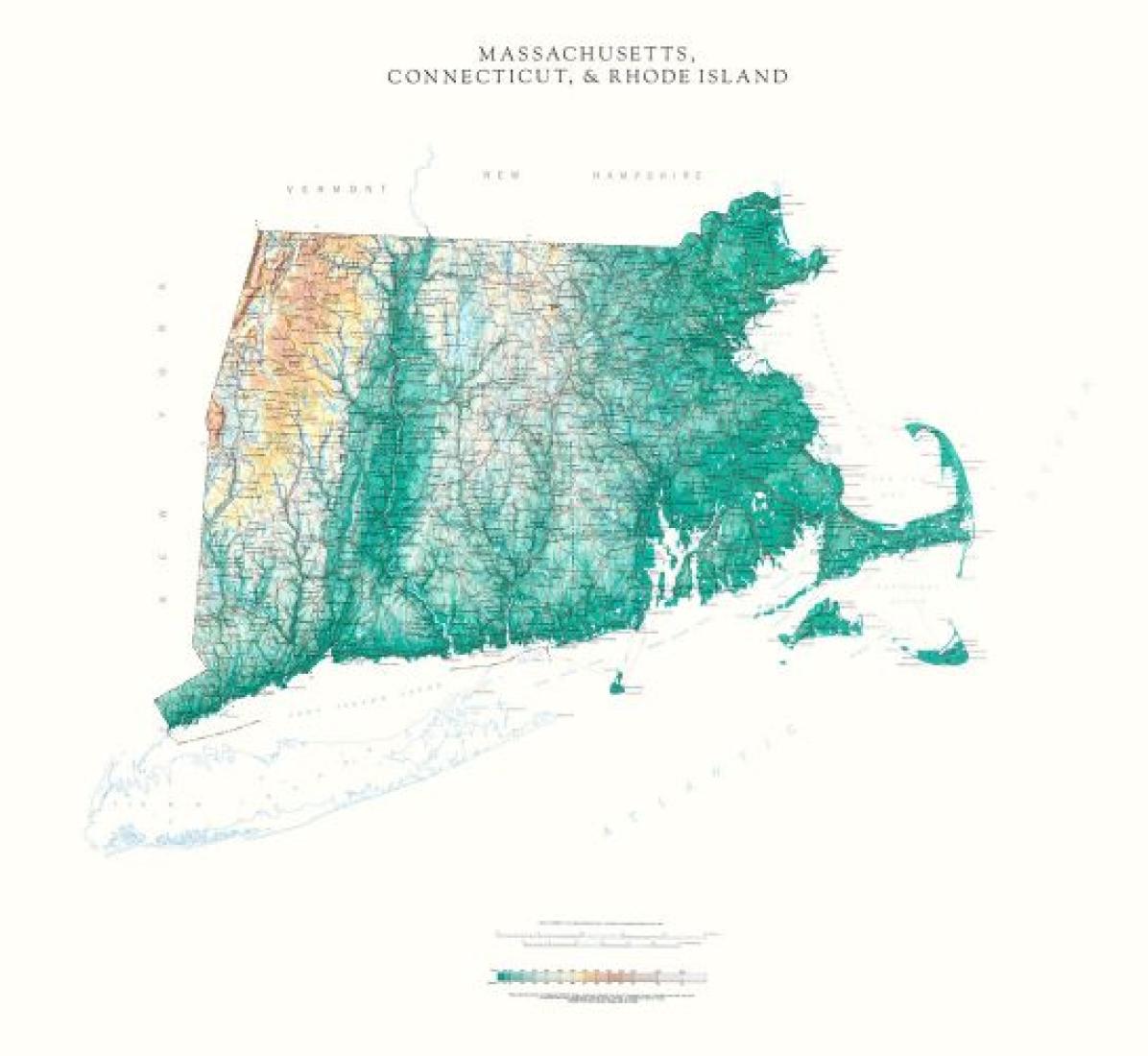
- Detailed physical wall map of Massachusetts, Connecticut & Rhode Island States at a scale of 1:500,000. The cartography shows relief through a stunning, highly detailed shading, with different elevations varying in color, giving an almost 3-dimensional feel to the map. Peak heights are also clearly marked. The map displays land only within the boundaries of the chosen states - there is no overlap with neighboring states. Principal physical features such as glaciers, mountain ranges, rivers and lakes are shown clearly. Human features, such as main towns, cities, roads and railways, are shown in a very fine, subtle and elegant cartographic style. State capitals are also clearly marked. This map measures 82 x 92cm (32" x 36"). This map of southern New England places the three historic states of Massachusetts, Rhode island and Connecticut together.
- Type: Wall Map
- Subtype: Physical
- Language: English
- Publication Date: 1990-06-01
- Scale: 1:500,000
- Regions Covered: Mid-Atlantic/Northeastern U.S., North America
- Countries Covered: United States
- States Covered: Connecticut, Massachusetts, Rhode Island
- ISBN: 9780783425658
- Folded Size: N/A
- Unfolded Size: 32" (W) x 36" (H)
- Weight: 14.47 oz
![Massachusetts, Connecticut, & Rhode Island [Physical, 32x36]](http://longitudemaps.com/cdn/shop/files/big_36500c40-b72d-45d8-a10f-55e8eec03471.jpg?v=1713957446&width=1445)