National Geographic Maps
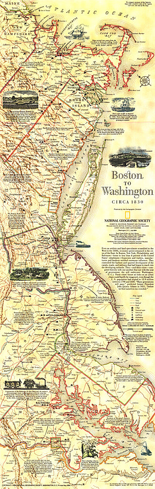
1830 Boston To Washington Circa 1830 Map
1830 Boston To Washington Circa 1830 Map
Regular price
$19.95 USD
Regular price
Sale price
$19.95 USD
Unit price
per
Shipping calculated at checkout.
Couldn't load pickup availability
- SKU: PODHNG_US_BOS_WAS_30
- This historical map is based on plates drafted by Henry Schenk Tanner which cover the Atlantic Coast from Boston to Washington, D.C. Features a variety of historical notes and illustrations. Published in July 1994 as half of a two–map set with "Boston to Washington, Megalopolis."
- Subtype: Wall Art
- Language: English
- Publication Date: 1830-06-01
- Countries Covered: United States
- MPN: HM19940701
- Folded Size: N/A
- Unfolded Size: 10" (W) x 31.25" (H)
- Weight: 16 oz