National Geographic Maps
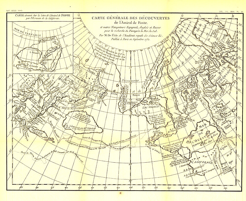
1892 Carte Generale Des Decouvertes De Lamiral De Fonte 1752 Map
1892 Carte Generale Des Decouvertes De Lamiral De Fonte 1752 Map
Regular price
$14.95 USD
Regular price
Sale price
$14.95 USD
Unit price
per
Shipping calculated at checkout.
Couldn't load pickup availability
- SKU: PODHNG_WOR_1752_92
- The "Carte Generale des Decouvertes de l'Amiral de Fonte" map is a black and white antique map created by Joseph-Nicolas De l'Isle in 1752 showing the supposed discoveries of Spanish explorer Admiral de la Fuente and the tracks of Spanish, English, and Russian navigators. These mythical "discoveries" included a Northwest Passage. Published in February 1892, it accompanied the article "The Cartography and Observations of Bering's First Voyage."
- Subtype: Historical
- Language: English
- Publication Date: 1892-06-01
- Regions Covered: World
- MPN: HM18920200
- Folded Size: N/A
- Unfolded Size: 15.75" (W) x 13" (H)
- Weight: 16 oz