National Geographic Maps
1892 United States of America Map
1892 United States of America Map
Regular price
$19.95 USD
Regular price
Sale price
$19.95 USD
Unit price
per
Shipping calculated at checkout.
Couldn't load pickup availability
- SKU: PODHNG_US_92
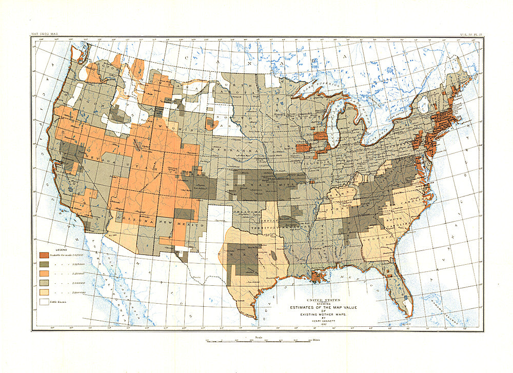
- Most cartographers will tell you that a map is only as good as the source information from which it is gathered. This United States map, first published in March of 1892, shows the US with an overlay describing the relative quality of source maps, or "Mother Maps" available at that time for various sections of the country. The map was painstakingly compiled by mapping pioneer Henry Gannett of the US Geological Survey.
- Subtype: Political
- Language: English
- Publication Date: 1892-06-01
- Countries Covered: United States
- MPN: HM18920302
- Folded Size: N/A
- Unfolded Size: 17.75" (W) x 13" (H)
- Weight: 16 oz