National Geographic Maps
1896 Submarine Cables of the World Map
1896 Submarine Cables of the World Map
Regular price
$39.95 USD
Regular price
Sale price
$39.95 USD
Unit price
per
Shipping calculated at checkout.
Couldn't load pickup availability
- SKU: PODHNG_WOR_SUBM_96
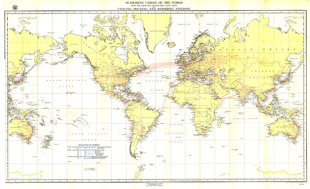
- Submarine cables have played an important part in the development of world-wide communications since the 1850's. This fascinating map, first develped for the Department of the Navy and published in National Geographic in 1896, shows submarine cables that had been laid, as well as the land-based cable systems that connected to them.
- Subtype: Wall Art
- Language: English
- Publication Date: 1896-06-01
- Regions Covered: World
- MPN: HM18960300
- Folded Size: N/A
- Unfolded Size: 49" (W) x 30" (H)
- Weight: 16 oz