National Geographic Maps
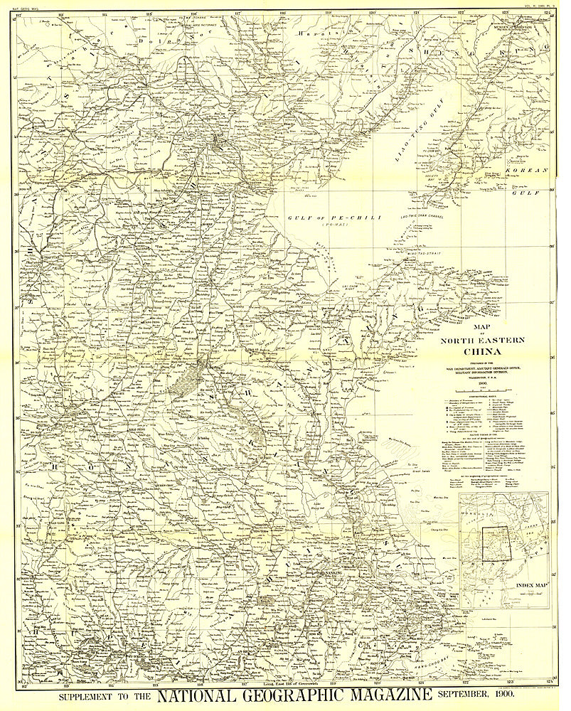
1900 Map of North Eastern China
1900 Map of North Eastern China
Regular price
$34.95 USD
Regular price
Sale price
$34.95 USD
Unit price
per
Shipping calculated at checkout.
Couldn't load pickup availability
- SKU: PODHNG_CHI_NE_00
- The first map of China printed by National Geographic, this historic black and white map is a true collector's item. Published in September 1900, it features translations of common terms and items of note such as the Great Wall and imperial tomb sites.
- Subtype: Political
- Language: English
- Publication Date: 1900-06-01
- Countries Covered: China
- MPN: HM19000900
- Folded Size: N/A
- Unfolded Size: 29.75" (W) x 37.25" (H)
- Weight: 16 oz