National Geographic Maps
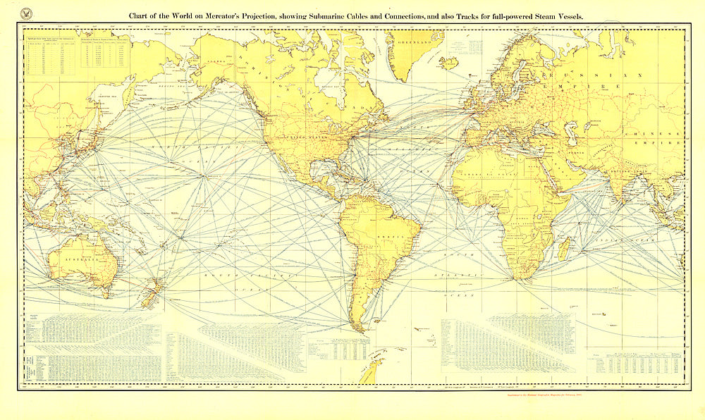
1905 Chart of the World on Mercator's Projection
1905 Chart of the World on Mercator's Projection
Regular price
$39.95 USD
Regular price
Sale price
$39.95 USD
Unit price
per
Shipping calculated at checkout.
Couldn't load pickup availability
- SKU: PODHNG_WOR_MERC_05
- Submarine cables have played an important part in the development of world-wide communications since the 1850's. National Geographic first charted these cables in 1896. In comparison to that earlier map, this map, published in February 1905 reveals the explosion of communications infrastructure worldwide at the beginning of the last century.
- Subtype: Wall Art
- Language: English
- Publication Date: 1905-06-01
- Regions Covered: World
- MPN: HM19050200
- Folded Size: N/A
- Unfolded Size: 46.75" (W) x 27.75" (H)
- Weight: 16 oz