National Geographic Maps
1912 Birds Eye View of the Panama Canal Map
1912 Birds Eye View of the Panama Canal Map
Regular price
$14.95 USD
Regular price
Sale price
$14.95 USD
Unit price
per
Shipping calculated at checkout.
Couldn't load pickup availability
- SKU: PODHNG_PAN_12
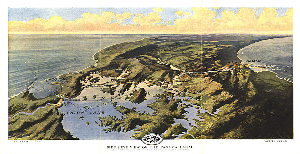
- Published in February 1912 two years before the Panama Canal opened, this stunning relief map-painting illustrates the Panama railroad, locks, breakwater, and other details of the region. One of the largest engineering projects ever undertaken, the canal had an enormous impact on shipping, creating a passage between the Pacific and Atlantic Oceans. Prior to the canal's opening, ships had to travel the long and treacherous route around the tip of South America.
- Subtype: Wall Art
- Language: English
- Publication Date: 1912-06-01
- Countries Covered: Panama
- MPN: HM19120200
- Folded Size: N/A
- Unfolded Size: 18.75" (W) x 9.5" (H)
- Weight: 16 oz