National Geographic Maps
1912 Countries Bordering the Mediterranean Sea Map
1912 Countries Bordering the Mediterranean Sea Map
Regular price
$19.95 USD
Regular price
Sale price
$19.95 USD
Unit price
per
Shipping calculated at checkout.
Couldn't load pickup availability
- SKU: PODHNG_MED_12
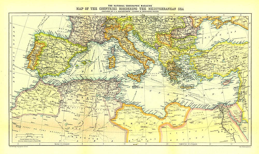
- The Map of Countries Bordering the Mediterranean Sea was published in January 1912, prior to the First Balkan War. This colorful map accompanied three articles of the region including "The Sea-Kings of Crete."
- Subtype: Political
- Language: English
- Publication Date: 1912-06-01
- Regions Covered: Mediterranean Sea
- MPN: HM19120100
- Folded Size: N/A
- Unfolded Size: 19.25" (W) x 11.5" (H)
- Weight: 16 oz