National Geographic Maps
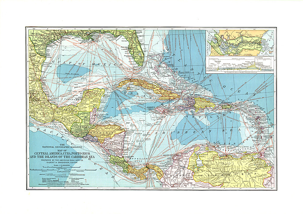
1913 Central America, Cuba, Porto Rico, and the Islands of the Caribbean Sea
1913 Central America, Cuba, Porto Rico, and the Islands of the Caribbean Sea
Regular price
$19.95 USD
Regular price
Sale price
$19.95 USD
Unit price
per
Shipping calculated at checkout.
Couldn't load pickup availability
- SKU: PODHNG_AMER_C_13
- This beautiful map of Central America and the Caribbean features ocean bathymetry and colorful county borders, including overlapping colors demonstrating boundaries in dispute. Published in February 1913 one year before the completion of the Panama Canal, this work contains an abundance of unique details including principal lighthouses, U.S. Consular representatives, steamship routes, and coaling stations.
- Subtype: Political
- Language: English
- Publication Date: 1913-06-01
- Regions Covered: Caribbean Sea
- MPN: HM19130200
- Folded Size: N/A
- Unfolded Size: 23.25" (W) x 16.25" (H)
- Weight: 16 oz