National Geographic Maps
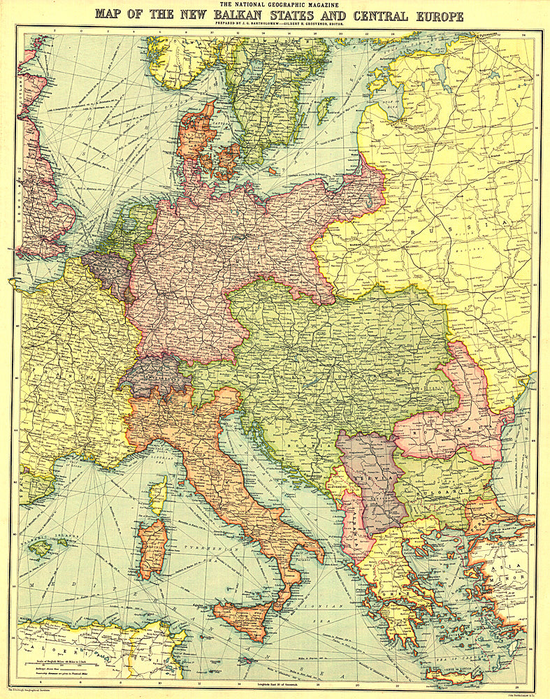
1914 New Balkan States and Central Europe Map
1914 New Balkan States and Central Europe Map
Regular price
$19.95 USD
Regular price
Sale price
$19.95 USD
Unit price
per
Shipping calculated at checkout.
Couldn't load pickup availability
- SKU: PODHNG_BALK_C_EUR_14
- This historic map of the Balkan States and Central Europe features vibrant color and steamship routes. Published in August 1914, it captured Central Europe as it stood at the start of the First World War.
- Subtype: Political
- Language: English
- Publication Date: 1914-06-01
- Regions Covered: Europe
- MPN: HM19140800
- Folded Size: N/A
- Unfolded Size: 18" (W) x 22.75" (H)
- Weight: 16 oz