National Geographic Maps
1932 Antarctic Regions Map
1932 Antarctic Regions Map
Regular price
$29.95 USD
Regular price
Sale price
$29.95 USD
Unit price
per
Shipping calculated at checkout.
Couldn't load pickup availability
- SKU: PODHNG_ANT_32
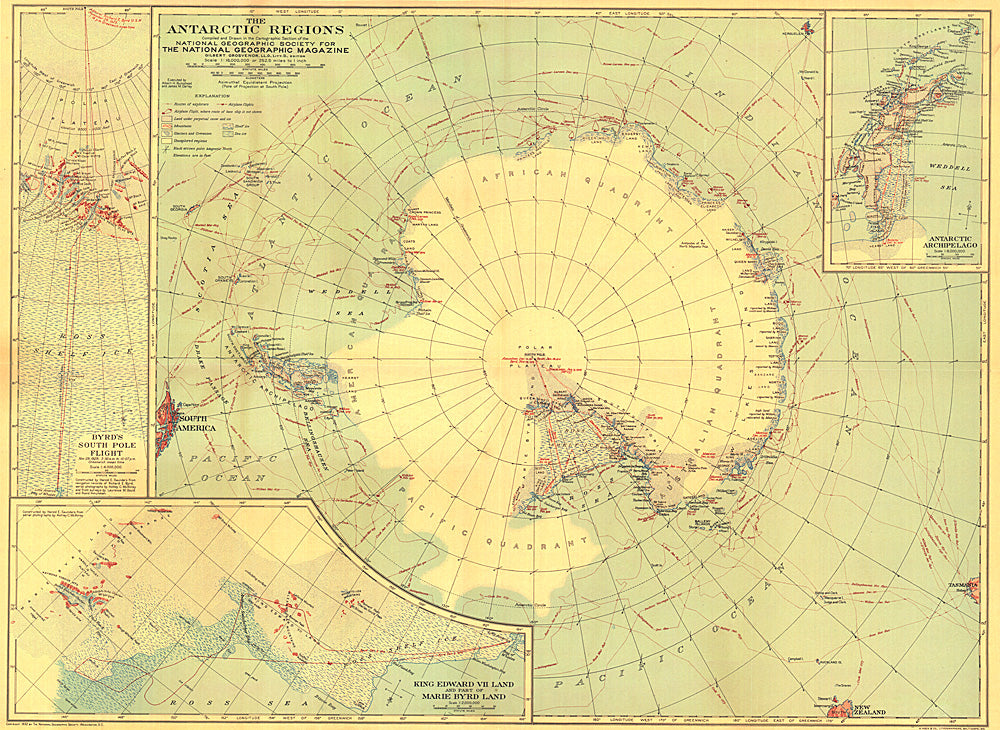
- This early map of the Antarctic regions was published in October 1932, just a few years after Byrd's historical flight over the South Pole. Parts of the inset maps were constructed using aerial photographs and the article "Mapping the Antarctic from the Air: The Aerial Camera Earns Its Place as the Eyes and Memory of the Explorer" appeared in the same issue of National Geographic.
- Subtype: Wall Art
- Language: English
- Publication Date: 1932-06-01
- Regions Covered: Antarctica
- MPN: HM19321000
- Folded Size: N/A
- Unfolded Size: 26.25" (W) x 19" (H)
- Weight: 16 oz