National Geographic Maps
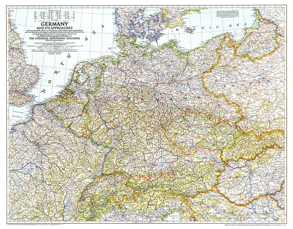
1944 Germany and Its Approaches 1938-1939 Map
1944 Germany and Its Approaches 1938-1939 Map
Regular price
$29.95 USD
Regular price
Sale price
$29.95 USD
Unit price
per
Shipping calculated at checkout.
Couldn't load pickup availability
- SKU: PODHNG_GER_44
- A must-have for those interested in World War II, this informative map was published in July 1944 with an article entitled "Landing Craft for Invasion." This work shows the international boundaries as of Sept. 1, 1939, the day Germany invaded Poland, and boundaries as of Jan. 1, 1938, before Germany seized Austria and Czechoslovakia.
- Subtype: Historical
- Language: English
- Publication Date: 1944-06-01
- Countries Covered: Germany
- MPN: HM19440700
- Folded Size: N/A
- Unfolded Size: 33.5" (W) x 26.25" (H)
- Weight: 16 oz