National Geographic Maps
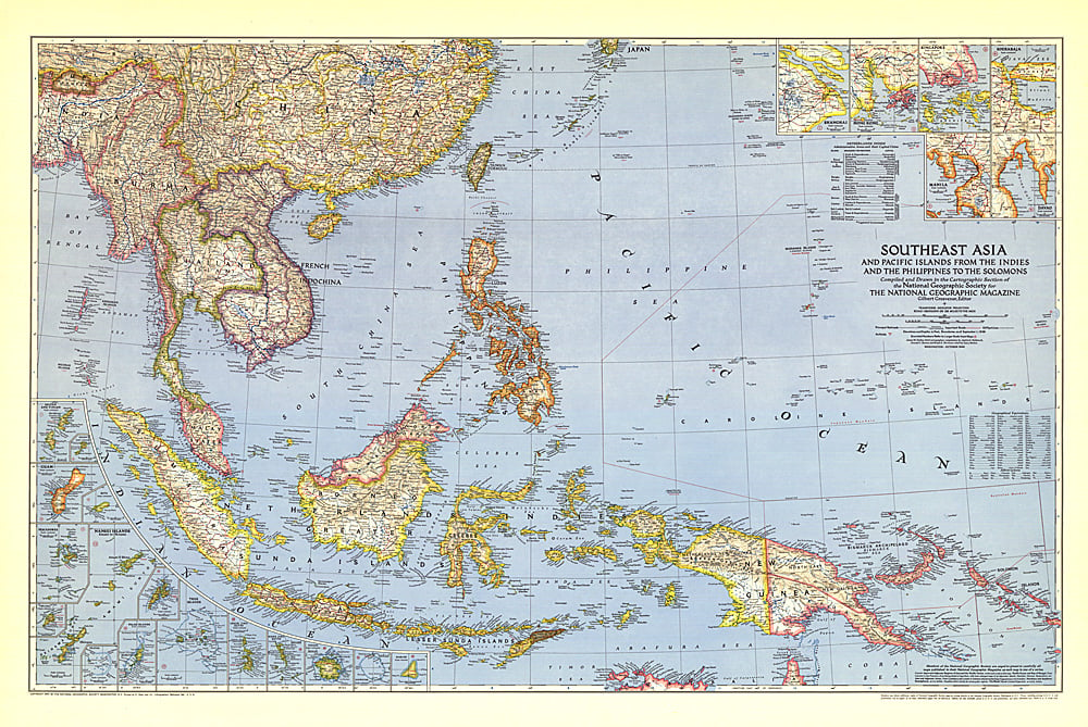
1944 Southeast Asia and the Pacific Islands Map
1944 Southeast Asia and the Pacific Islands Map
Regular price
$34.95 USD
Regular price
Sale price
$34.95 USD
Unit price
per
Shipping calculated at checkout.
Couldn't load pickup availability
- SKU: PODHNG_ASIA_SE_44
- Published in October 1944 during the second world war, this map of Southeast Asia and the Pacific Islands shows boundaries as of September 1, 1939. With over twenty inset maps of islands and cities, this map provides exceptional detail of the region, including administrative areas of the Netherlands Indies and capitals.
- Subtype: Political
- Language: English
- Publication Date: 1944-06-01
- Regions Covered: Asia
- MPN: HM19441000
- Folded Size: N/A
- Unfolded Size: 41.5" (W) x 27.75" (H)
- Weight: 16 oz
