National Geographic Maps
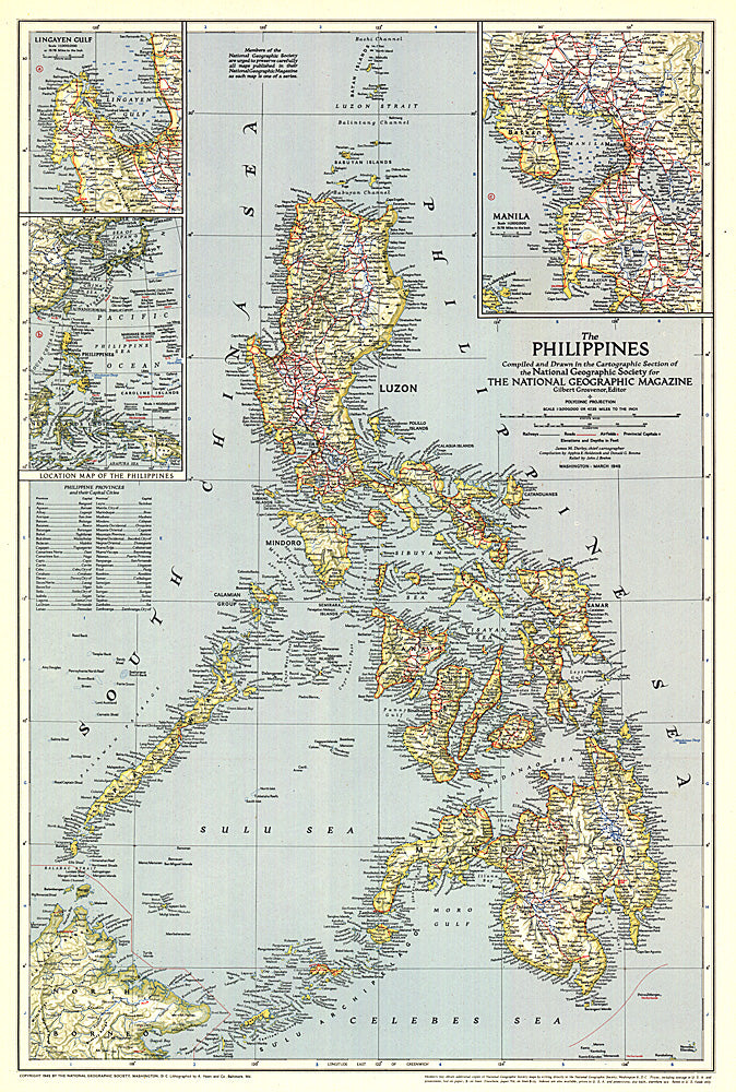
1945 Philippines Map
1945 Philippines Map
Regular price
$24.95 USD
Regular price
Sale price
$24.95 USD
Unit price
per
Shipping calculated at checkout.
Couldn't load pickup availability
- SKU: PODHNG_PHIL_45
- The Philippines were liberated from the Japanese by MacArthur's forces just months before this map was published in March 1945. This map, which accompanied the article "What Luzon Means to Uncle Sam," features the provinces and their capitals as well as airfields. A fine collectible for those interested in World War II era maps.
- Subtype: Political
- Language: English
- Publication Date: 1945-06-01
- Countries Covered: Philippines
- MPN: HM19450300
- Folded Size: N/A
- Unfolded Size: 17.5" (W) x 26" (H)
- Weight: 16 oz