National Geographic Maps
1946 Political Subdivisions of India Map
1946 Political Subdivisions of India Map
Regular price
$29.95 USD
Regular price
Sale price
$29.95 USD
Unit price
per
Shipping calculated at checkout.
Couldn't load pickup availability
- SKU: PODHNG_INDIA_46
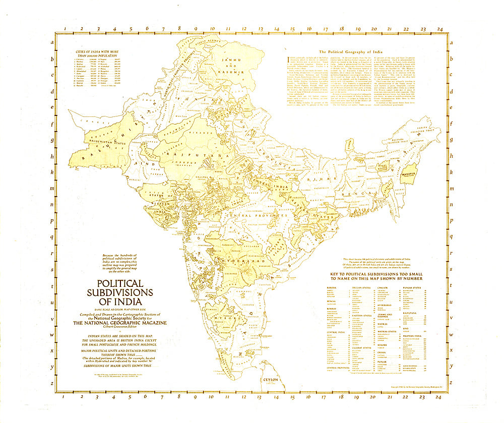
- Because the hundreds of political subdivisions of India are so complex, this outline map was prepared to amplify the map of India and Burma which appeared in the same issue. Published in April 1946 with three articles on India, these historical maps capture the region known then as India a year before the independent countries of India and Pakistan were formed.
- Subtype: Political
- Language: English
- Publication Date: 1946-06-01
- Countries Covered: India
- MPN: HM19460402
- Folded Size: N/A
- Unfolded Size: 31" (W) x 26" (H)
- Weight: 16 oz