National Geographic Maps
1947 Countries of the Caribbean Map
1947 Countries of the Caribbean Map
Regular price
$34.95 USD
Regular price
Sale price
$34.95 USD
Unit price
per
Shipping calculated at checkout.
Couldn't load pickup availability
- SKU: PODHNG_CAR_47
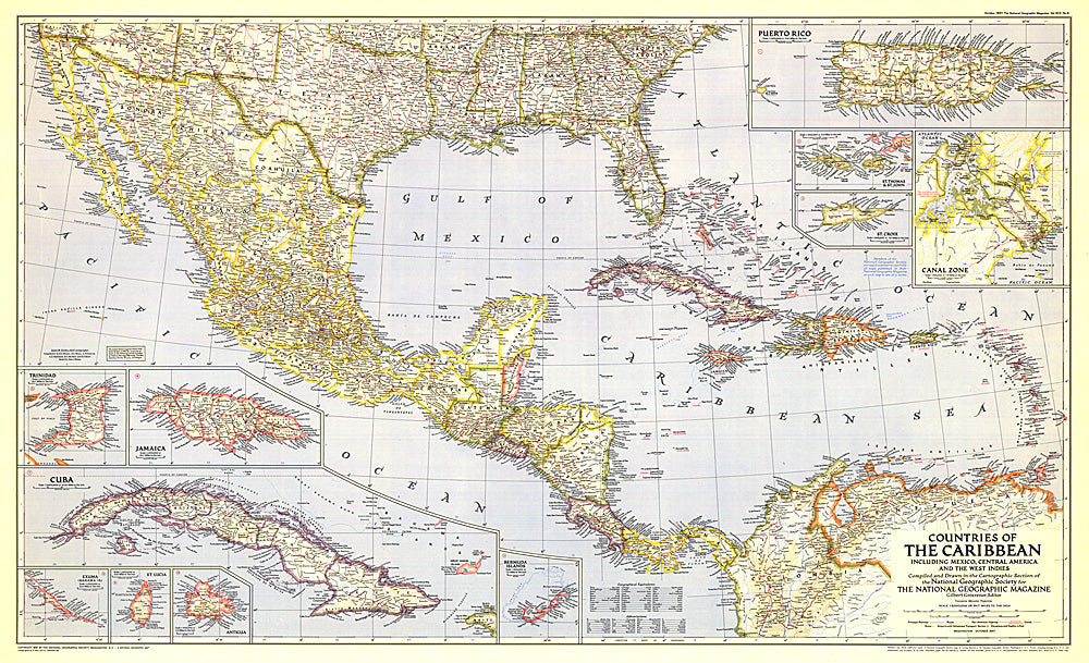
- Published in October 1947, this map of the Countries of the Caribbean features Mexico, Central America, and the West Indies as well the islands of the Caribbean. Inset maps of ten of the most prominent islands and the Panama Canal zone provide detail of the region. The article "Guatemala Revisited" accompanied the map.
- Subtype: Political
- Language: English
- Publication Date: 1947-06-01
- Regions Covered: Caribbean Sea
- MPN: HM19471000
- Folded Size: N/A
- Unfolded Size: 40.75" (W) x 24.75" (H)
- Weight: 16 oz