National Geographic Maps
1947 South Central United States Map
1947 South Central United States Map
Regular price
$29.95 USD
Regular price
Sale price
$29.95 USD
Unit price
per
Shipping calculated at checkout.
Couldn't load pickup availability
- SKU: PODHNG_US_S_C_47
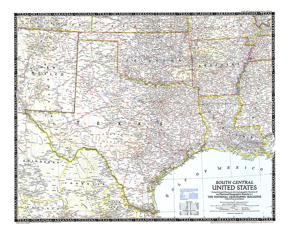
- The fifth in a series of six sectional maps of the U.S., the South Central United States map was published in December 1947 and includes the states of Texas, Oklahoma, Arkansas, Louisiana, Mississippi, and much of New Mexico. This map series was printed between 1940 and 1948.
- Subtype: Political
- Language: English
- Publication Date: 1947-06-01
- Countries Covered: United States
- MPN: HM19471200
- Folded Size: N/A
- Unfolded Size: 31.25" (W) x 24.5" (H)
- Weight: 16 oz