National Geographic Maps
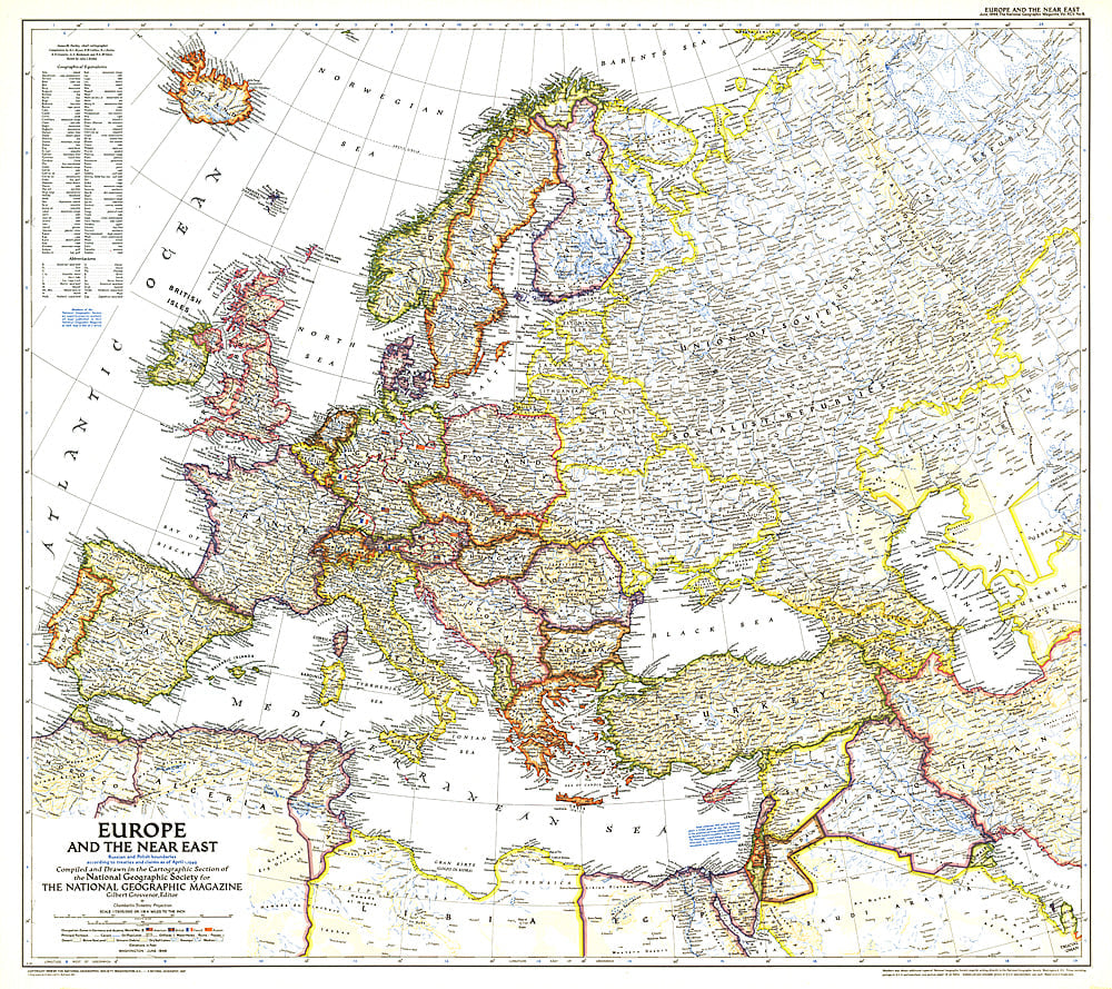
1949 Europe and the Near East Map
1949 Europe and the Near East Map
Regular price
$29.95 USD
Regular price
Sale price
$29.95 USD
Unit price
per
Shipping calculated at checkout.
Couldn't load pickup availability
- SKU: PODHNG_EUR_49
- A striking rendering of post-war Europe, this map is unique in its lack of ocean color. Colorful borders leap off the white page projecting an optimistic tone. Published in June 1949 with the article "Italy Smiles Again," this map shows American, British, French, and Russian occupational zones in Germany and Austria.
- Subtype: Political
- Language: English
- Publication Date: 1949-06-01
- Regions Covered: Europe
- MPN: HM19490600
- Folded Size: N/A
- Unfolded Size: 31.75" (W) x 28.25" (H)
- Weight: 16 oz