National Geographic Maps
1949 Top of the World Map
1949 Top of the World Map
Regular price
$29.95 USD
Regular price
Sale price
$29.95 USD
Unit price
per
Shipping calculated at checkout.
Couldn't load pickup availability
- SKU: PODHNG_ARC_49
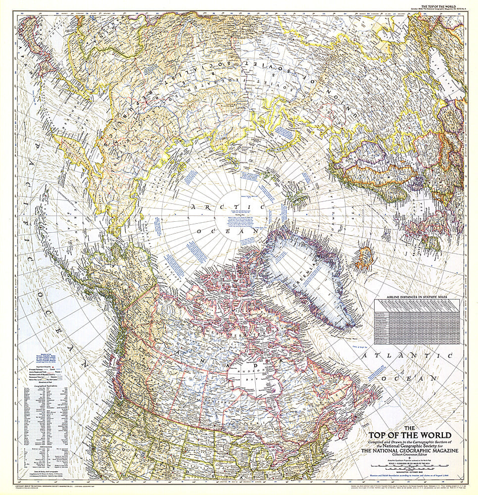
- In the October 1949 issue of National Geographic, there were five articles related to polar exploration. The Top of the World map, first published in October of 1949, offers a truly unique view that features the Arctic Polar Region at its center. This beautiful map is both a cartographic masterpiece and a fresh look at the world.
- Subtype: Wall Art
- Language: English
- Publication Date: 1949-06-01
- Regions Covered: Arctic
- MPN: HM19491000
- Folded Size: N/A
- Unfolded Size: 28.5" (W) x 29.5" (H)
- Weight: 16 oz