National Geographic Maps
1950 Northwestern United States and Canadian Provinces Map
1950 Northwestern United States and Canadian Provinces Map
Regular price
$34.95 USD
Regular price
Sale price
$34.95 USD
Unit price
per
Shipping calculated at checkout.
Couldn't load pickup availability
- SKU: PODHNG_US_CAN_NW_50
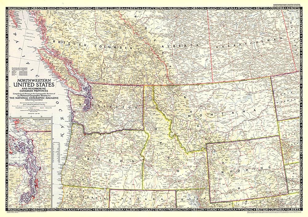
- The Northwestern United States and Neighboring Canadian Provinces map is the sixth in a series of sectional maps of the United States dated from 1945 to 1950. Published in June 1950, it provides a thorough look at the states of Washington, Oregon, Idaho, Montana, and Wyoming, as well as the southern portions of British Columbia, Alberta, and Saskatchewan.
- Subtype: Political
- Language: English
- Publication Date: 1950-06-01
- Countries Covered: Canada, United States
- States Covered: Alberta, British Columbia, Idaho, Montana, Saskatchewan, Washington, Wyoming
- MPN: HM19500600
- Folded Size: N/A
- Unfolded Size: 36.25" (W) x 25.5" (H)
- Weight: 16 oz