National Geographic Maps
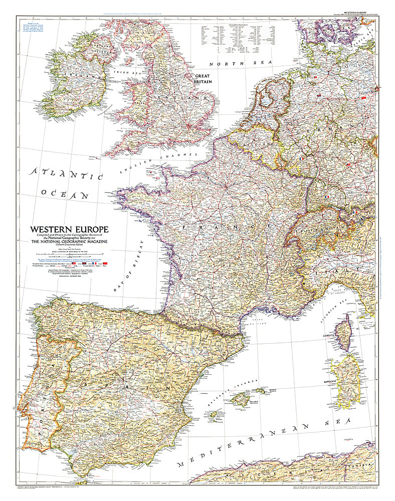
1950 Western Europe Map
1950 Western Europe Map
Regular price
$34.95 USD
Regular price
Sale price
$34.95 USD
Unit price
per
Shipping calculated at checkout.
Couldn't load pickup availability
- SKU: PODHNG_EUR_W_50
- Published in December 1950, the Western Europe map is a snapshot of the region as it stood shortly after the end of the Second World War. The status of the Saar and the minor adjustments in Germany's boundary with the Netherlands, Belgium, Luxembourg, and France are provisional at the time, pending a treaty of peace with Germany.
- Subtype: Political
- Language: English
- Publication Date: 1950-06-01
- Regions Covered: Europe
- MPN: HM19501200
- Folded Size: N/A
- Unfolded Size: 30" (W) x 38" (H)
- Weight: 16 oz