National Geographic Maps
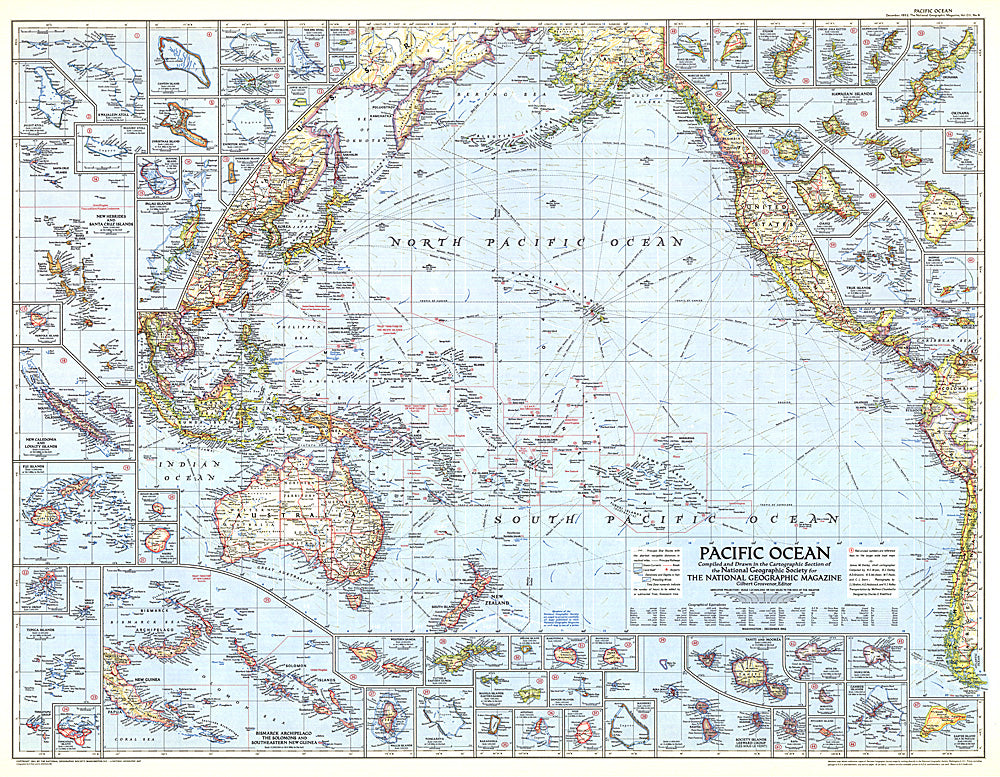
1952 Pacific Ocean Map
1952 Pacific Ocean Map
Regular price
$34.95 USD
Regular price
Sale price
$34.95 USD
Unit price
per
Shipping calculated at checkout.
Couldn't load pickup availability
- SKU: PODHNG_PAC_O_52
- A fascinating piece, this map of the Pacific was published in December 1952 and included inset maps of dozens of islands. Particular features that make this map noteworthy are weather stations, ocean currents, and prevailing winds. A great companion to the Pacific Ocean map of 1936.
- Subtype: Wall Art
- Language: English
- Publication Date: 1952-06-01
- Regions Covered: Pacific Ocean
- MPN: HM19521200
- Folded Size: N/A
- Unfolded Size: 37.25" (W) x 29" (H)
- Weight: 16 oz