National Geographic Maps
1953 The Great Lakes Region of the United States and Canada
1953 The Great Lakes Region of the United States and Canada
Regular price
$39.95 USD
Regular price
Sale price
$39.95 USD
Unit price
per
Shipping calculated at checkout.
Couldn't load pickup availability
- SKU: PODHNG_US_CAN_GRE_LAK_53
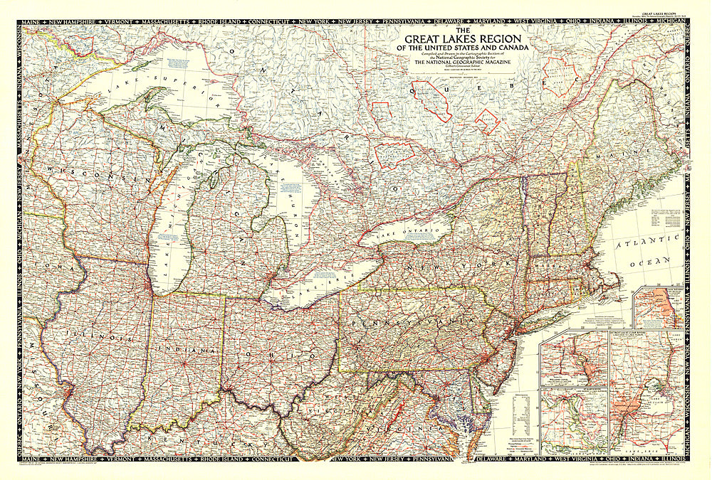
- This map showcases the Great Lakes Region of the United States and Canada. Includes four insets: Illinois waterways (Lake Michigan to Lockport), Welland canal (Lake Ontario to Lake Erie), St. Marys River (Lake Huron to Lake Superior), and Detroit and St. Clair Rivers (Lake Erie to Lake Huron). Published in 1953.
- Subtype: Political
- Language: English
- Publication Date: 1953-06-01
- Countries Covered: Canada, United States
- States Covered: Connecticut, Illinois, Indiana, Iowa, Kentucky, Maine, Maryland, Massachusetts, Michigan, Minnesota, Missouri, New Hampshire, New York, Ohio, Ontario, Pennsylvania, Quebec, Rhode Island, Vermont, Virginia, West Virginia, Wisconsin
- MPN: HM19531200
- Folded Size: N/A
- Unfolded Size: 43" (W) x 29" (H)
- Weight: 16 oz