National Geographic Maps
1954 Northern Europe Map
1954 Northern Europe Map
Regular price
$34.95 USD
Regular price
Sale price
$34.95 USD
Unit price
per
Shipping calculated at checkout.
Couldn't load pickup availability
- SKU: PODHNG_EUR_N_54
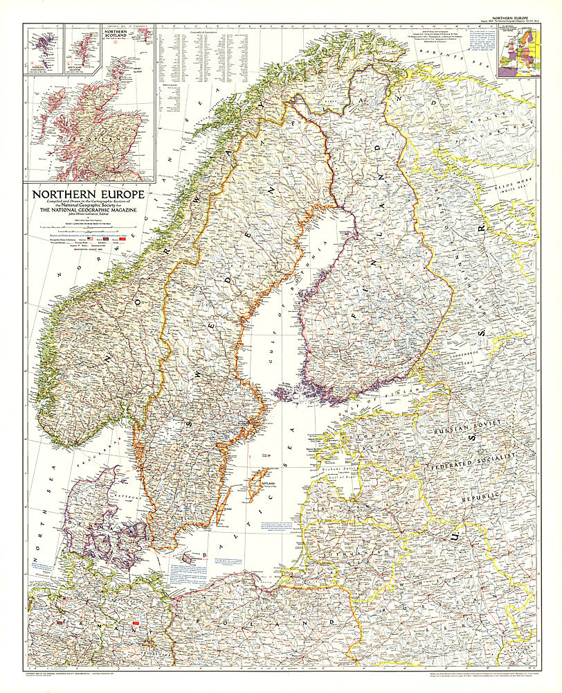
- This map of Northern Europe shows the boundaries of Poland and Russia as of June 1, 1954. It also notes American, British, and Russian occupation zones in Germany. Published in August 1954.
- Subtype: Political
- Language: English
- Publication Date: 1954-06-01
- Regions Covered: Europe
- MPN: HM19540800
- Folded Size: N/A
- Unfolded Size: 30" (W) x 36.75" (H)
- Weight: 16 oz