National Geographic Maps
1954 West Indies Map
1954 West Indies Map
Regular price
$34.95 USD
Regular price
Sale price
$34.95 USD
Unit price
per
Shipping calculated at checkout.
Couldn't load pickup availability
- SKU: PODHNG_W_IND_54
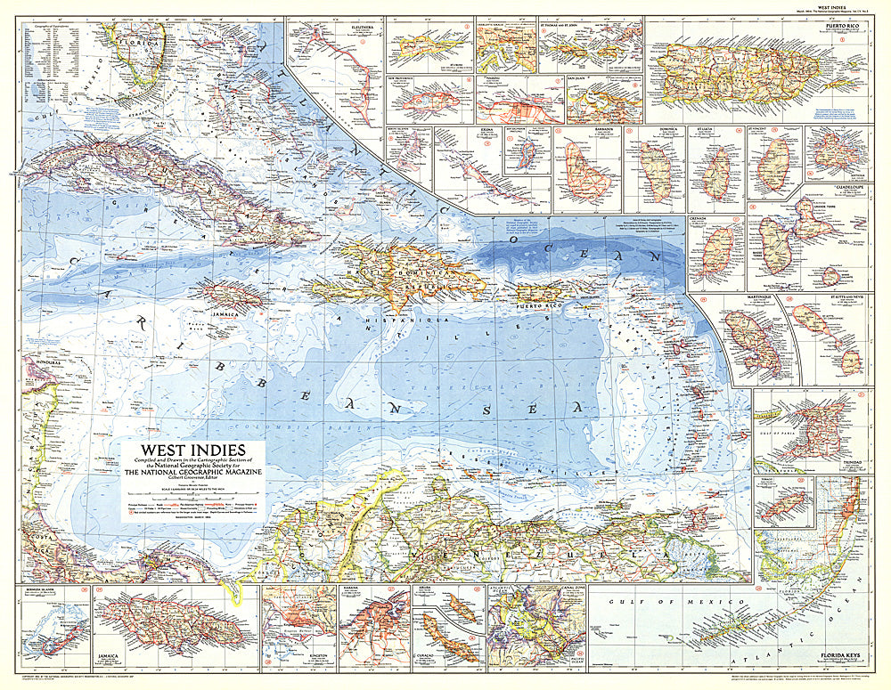
- This colorful map of the West Indies contains thirty inset maps providing spectacular detail of the many islands in the Caribbean. Published in March 1954 with two articles, "Jamaica - Hub of the Caribbean" and "Night Life in the Gulf Stream."
- Subtype: Political
- Language: English
- Publication Date: 1954-06-01
- Countries Covered: Bahamas, Barbados, Colombia, Costa Rica, Cuba, Dominica, Grenada, Guadeloupe, Haiti, Jamaica, Martinique, Nicaragua, Puerto Rico, Saint Barthelemy, Saint Kitts and Nevis, Saint Lucia, Saint Martin, Saint Vincent and the Grenadines, United States, Venezuela
- MPN: HM19540300
- Folded Size: N/A
- Unfolded Size: 37.25" (W) x 29" (H)
- Weight: 16 oz