National Geographic Maps
1958 British Isles Map
1958 British Isles Map
Regular price
$24.95 USD
Regular price
Sale price
$24.95 USD
Unit price
per
Shipping calculated at checkout.
Couldn't load pickup availability
- SKU: PODHNG_UK_58
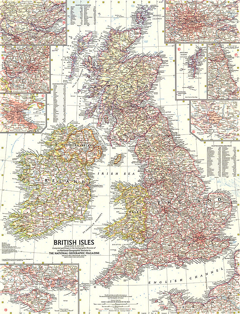
- This map of the British Isles includes detailed insets of major cities as well as the Isle of Wight and the Shetland Islands. Includes counties and their abbreviations. Published in July 1958.
- Subtype: Political
- Language: English
- Publication Date: 1958-06-01
- Countries Covered: United Kingdom
- MPN: HM19580700
- Folded Size: N/A
- Unfolded Size: 19" (W) x 24.75" (H)
- Weight: 16 oz