National Geographic Maps
1960 France, Belgium and the Netherlands Map
1960 France, Belgium and the Netherlands Map
Regular price
$24.95 USD
Regular price
Sale price
$24.95 USD
Unit price
per
Shipping calculated at checkout.
Couldn't load pickup availability
- SKU: PODHNG_FR_BG_NE_60
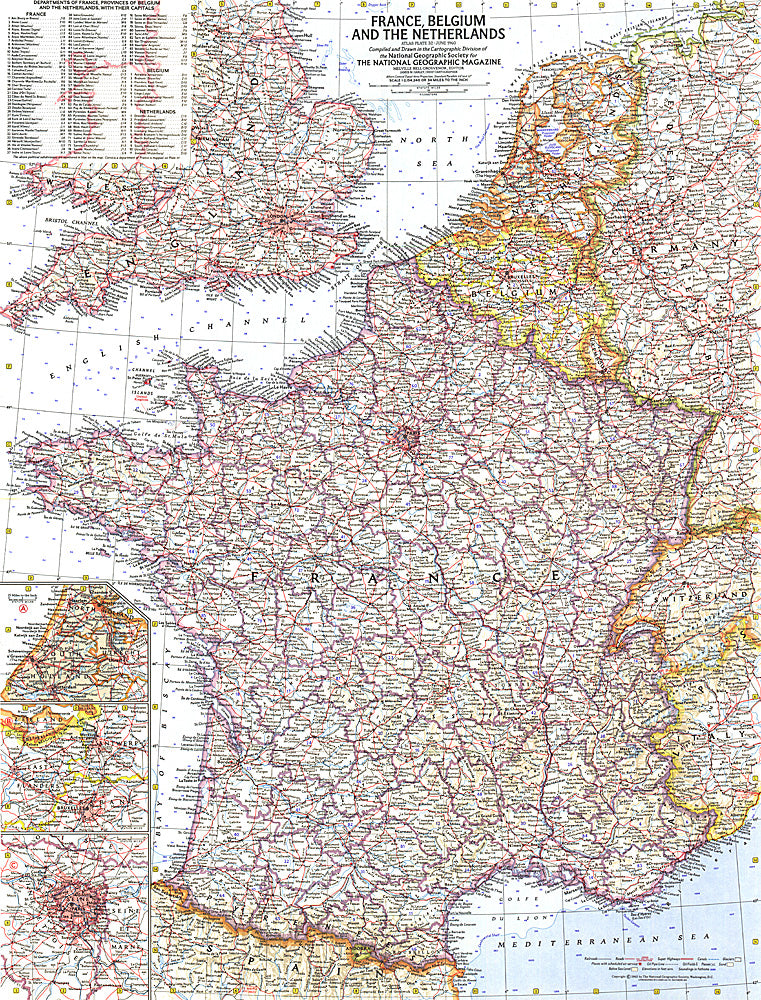
- This detailed map of France, Belgium and the Netherlands is unique in its focus on these three particular countries. Features a list of the "départements", or administrative divisions, for each country and their capitals. Includes inset maps of Paris, Amsterdam, and Brussels. Published in June 1960.
- Subtype: Political
- Language: English
- Publication Date: 1960-06-01
- Countries Covered: France
- MPN: HM19600600
- Folded Size: N/A
- Unfolded Size: 19" (W) x 24.75" (H)
- Weight: 16 oz