National Geographic Maps
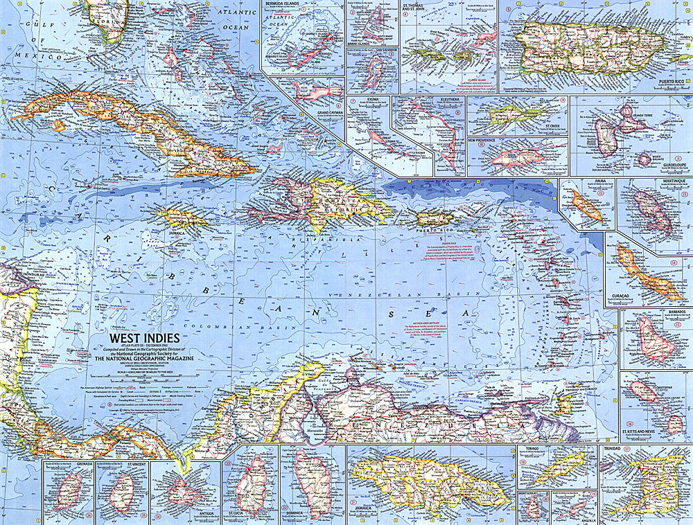
1962 West Indies Map
1962 West Indies Map
Regular price
$24.95 USD
Regular price
Sale price
$24.95 USD
Unit price
per
Shipping calculated at checkout.
Couldn't load pickup availability
- SKU: PODHNG_W_IND_62
- This colorful and detailed map of the West Indies features inset maps of over two dozen islands, as well as ocean bathymetry, currents, and prevailing winds. Operation Bootstrap was the name given to ambitious projects which rapidly industrialized Puerto Rico in the 1950s, shifting the region's economy from agriculture to manufacturing. Published in December 1962 with the article "Puerto Rico's Seven-league Bootstraps."
- Subtype: Political
- Language: English
- Publication Date: 1962-06-01
- Countries Covered: Anguilla, Antigua and Barbuda, Aruba, Bahamas, Barbados, Cayman Islands, Cuba, Curacao, Dominica, Dominican Republic, Grenada, Guadeloupe, Guyana, Haiti, Jamaica, Martinique, Montserrat, Puerto Rico, Saint Barthelemy, Saint Kitts and Nevis, Saint Lucia, Saint Martin, Saint Vincent and the Grenadines, Trinidad and Tobago, Turks and Caicos Islands, Virgin Islands, British, Virgin Islands, United States
- MPN: HM19621200
- Folded Size: N/A
- Unfolded Size: 25" (W) x 19" (H)
- Weight: 16 oz