National Geographic Maps
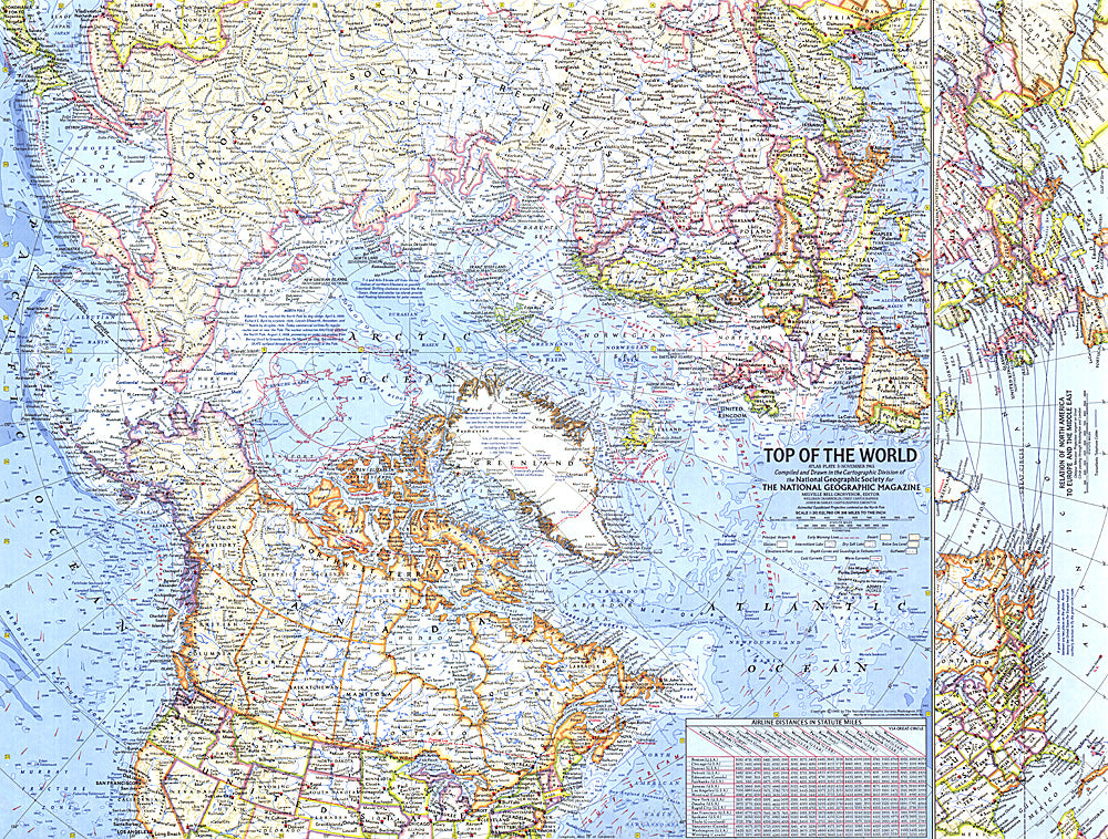
1965 Top of the World Map
1965 Top of the World Map
Regular price
$24.95 USD
Regular price
Sale price
$24.95 USD
Unit price
per
Shipping calculated at checkout.
Couldn't load pickup availability
- SKU: PODHNG_ARC_65
- In the mid 1960s, the USSR and US were in the midst of a cold war, in which each nation was acutely aware of its proximity to the other. This map offers a truly unique view that features the Arctic Polar Region at its center, as well as the "Early Warning Lines" for the United States in case of imminent nuclear attack from the USSR. Published in November of 1965.
- Subtype: Wall Art
- Language: English
- Publication Date: 1965-06-01
- Regions Covered: Arctic
- MPN: HM19651100
- Folded Size: N/A
- Unfolded Size: 24.75" (W) x 18.75" (H)
- Weight: 16 oz