National Geographic Maps
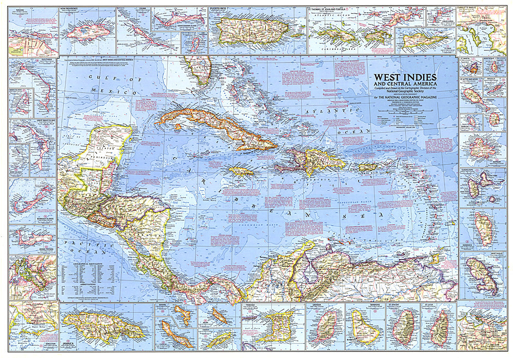
1970 West Indies and Central America Map
1970 West Indies and Central America Map
Regular price
$34.95 USD
Regular price
Sale price
$34.95 USD
Unit price
per
Shipping calculated at checkout.
Couldn't load pickup availability
- SKU: PODHNG_AMER_C_70
- This wonderfully detailed map of the West Indies and Central America includes inset maps of over thirty islands, four cities, and the Panama Canal. A particularly unique feature of this map is the splashdown points of various space missions. Published in January 1970 to accompany the article "The Netherlands Antilles: Holland in the Caribbean."
- Subtype: Political
- Language: English
- Publication Date: 1970-06-01
- Regions Covered: Central America
- MPN: HM19700100
- Folded Size: N/A
- Unfolded Size: 38" (W) x 26.5" (H)
- Weight: 16 oz