National Geographic Maps
1975 Close-up USA, Maine Map
1975 Close-up USA, Maine Map
Regular price
$29.95 USD
Regular price
Sale price
$29.95 USD
Unit price
per
Shipping calculated at checkout.
Couldn't load pickup availability
- SKU: PODHNG_US_ME_75
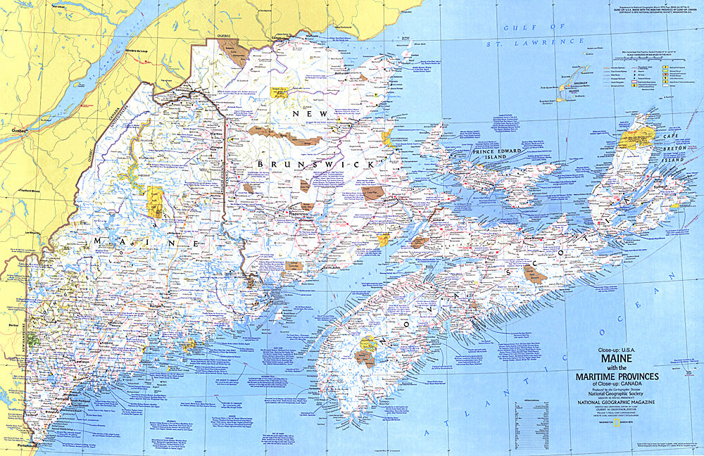
- This map details Maine, the most northeastern state in the United States, as well as the surrounding Canadian maritime provinces of New Brunswick, Nova Scotia, and Prince Edward Island. Includes a wealth of notes about the festivals, events, and historical sites one can visit in this scenic region. Published in March 1975 as part of the "Close-up: U.S.A." series, with a companion travel poster and an article on Nova Scotia.
- Subtype: Wall Art
- Language: English
- Publication Date: 1975-06-01
- Countries Covered: United States
- States Covered: Maine
- MPN: HM19750301
- Folded Size: N/A
- Unfolded Size: 35" (W) x 22.75" (H)
- Weight: 16 oz