National Geographic Maps
1976 Portrait USA Map
1976 Portrait USA Map
Regular price
$39.95 USD
Regular price
Sale price
$39.95 USD
Unit price
per
Shipping calculated at checkout.
Couldn't load pickup availability
- SKU: PODHNG_US_POR_76
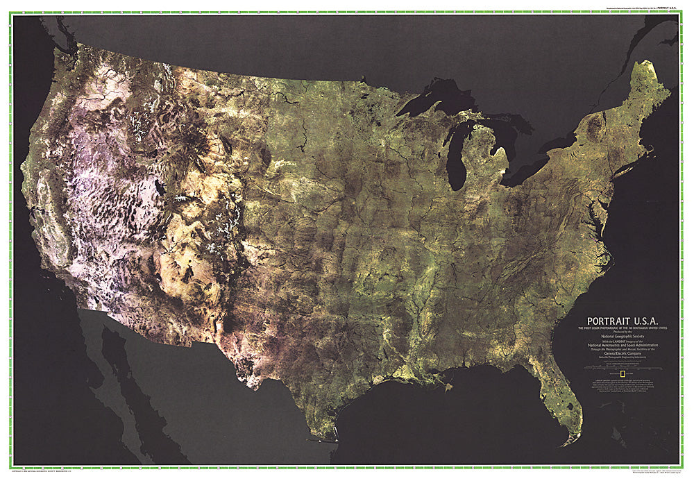
- The first color satellite photomosaic of the 48 contiguous United States, this landmark map was published in July of 1976. The near-true color imagery creates a portrait of the patchwork quilt of the entire country. Trace the Mississippi river from its source to the Gulf of Mexico. See the deserts of New Mexico, Arizona, and California. Follow the Rocky Mountains through the western states. A cartographic benchmark, this map laid the groundwork for the many that have followed.
- Subtype: Wall Art
- Language: English
- Publication Date: 1976-06-01
- Countries Covered: United States
- MPN: HM19760702
- Folded Size: N/A
- Unfolded Size: 42.5" (W) x 29.5" (H)
- Weight: 16 oz