National Geographic Maps
1978 British Columbia, Alberta and the Yukon Territory Map
1978 British Columbia, Alberta and the Yukon Territory Map
Regular price
$29.95 USD
Regular price
Sale price
$29.95 USD
Unit price
per
Shipping calculated at checkout.
Couldn't load pickup availability
- SKU: PODHNG_CAN_BC_AB_YT_78
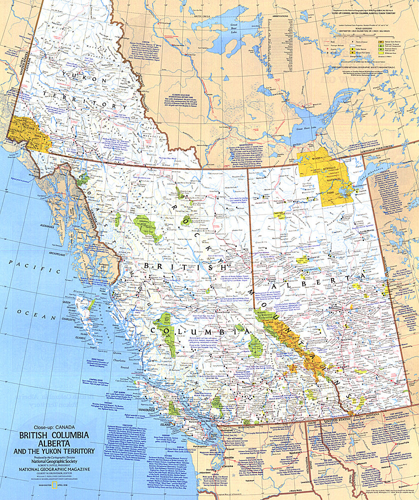
- This travel map of the Canadian provinces of British Columbia, Alberta and the Yukon Territory shows hundreds of national parks, wilderness areas, campgrounds and ski resorts. It also highlights points of interest in cities such as Vancouver, Victoria, Edmonton, and Dawson. Published in April 1978.
- Subtype: Political
- Language: English
- Publication Date: 1978-06-01
- Countries Covered: Canada
- MPN: HM19780401
- Folded Size: N/A
- Unfolded Size: 22.75" (W) x 27" (H)
- Weight: 16 oz