National Geographic Maps
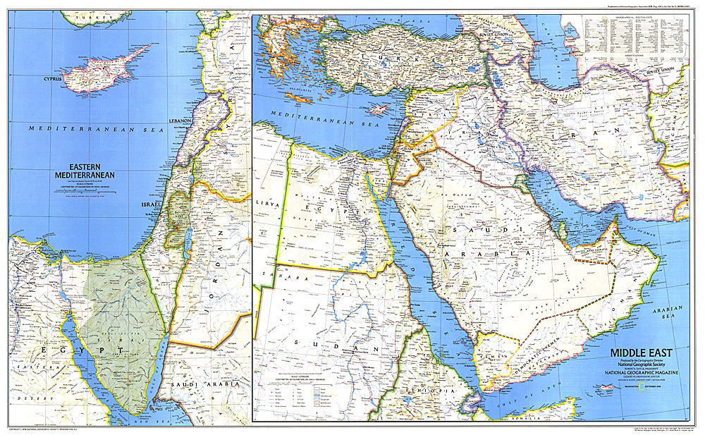
1978 Middle East Map
1978 Middle East Map
Regular price
$29.95 USD
Regular price
Sale price
$29.95 USD
Unit price
per
Shipping calculated at checkout.
Couldn't load pickup availability
- SKU: PODHNG_ME_78
- When this map of the Middle East was created, Israel had occupied the West Bank, Sinai Peninsula, and Golan Heights for over a decade. Six months later, after signing the Israel-Egypt Peace Treaty, Israel withdrew from the Sinai Peninsula and evacuated the settlements it had established there during the 1970s. Published in September 1978 as a companion to the historical map "Early Civilizations in the Middle East."
- Subtype: Political
- Language: English
- Publication Date: 1978-06-01
- Regions Covered: Middle East
- MPN: HM19780901
- Folded Size: N/A
- Unfolded Size: 37" (W) x 22.75" (H)
- Weight: 16 oz