National Geographic Maps
1986 Where Did Columbus Discover America? Map
1986 Where Did Columbus Discover America? Map
Regular price
$19.95 USD
Regular price
Sale price
$19.95 USD
Unit price
per
Shipping calculated at checkout.
Couldn't load pickup availability
- SKU: PODHNG_AMER_CC_8
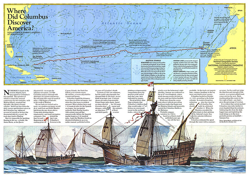
- The exact site of Christopher Columbus's first landfall in the New World has been a controversial subject since his arrival in The Bahamas in 1492. Watling Island, renamed San Salvador, has been the choice of many scholars. A new theory presented by Luis and Ethel Marden, who tracked the journey presented on this map, points to Samana Cay. Published in National Geographic Magazine in November 1986 with the "Threading the Islands" map and three articles on Columbus.
- Subtype: Historical
- Language: English
- Publication Date: 1986-06-01
- Regions Covered: North America
- MPN: HM19861101
- Folded Size: N/A
- Unfolded Size: 20.5" (W) x 14.5" (H)
- Weight: 16 oz