National Geographic Maps
1988 High Himalaya Map
1988 High Himalaya Map
Regular price
$29.95 USD
Regular price
Sale price
$29.95 USD
Unit price
per
Shipping calculated at checkout.
Couldn't load pickup availability
- SKU: PODHNG_HIMAL_88
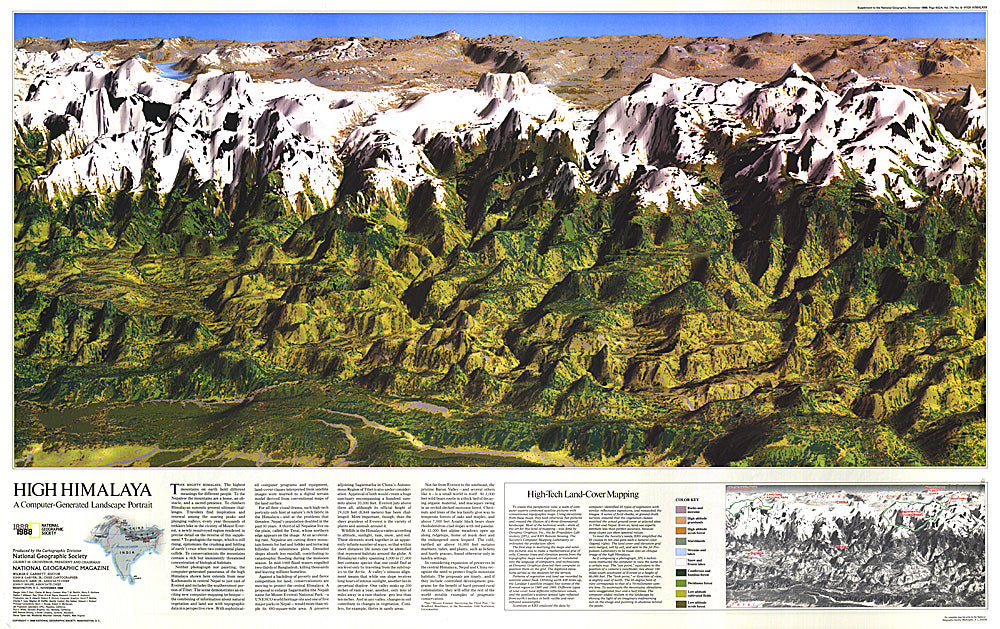
- This computer-generated panorama of the Himalayas from Kathmandu to just east of Mount Everest is neither photograph nor painting, though it resembles both with its dimension and color. Published in November 1988 with a companion map of and three articles about Mount Everest, this stunning map brings these majestic mountains to life in striking relief.
- Subtype: Wall Art
- Language: English
- Publication Date: 1988-06-01
- Countries Covered: Nepal
- MPN: HM19881101
- Folded Size: N/A
- Unfolded Size: 35.75" (W) x 22.5" (H)
- Weight: 16 oz