National Geographic Maps
1995 Above the Rockies Map
1995 Above the Rockies Map
Regular price
$29.95 USD
Regular price
Sale price
$29.95 USD
Unit price
per
Shipping calculated at checkout.
Couldn't load pickup availability
- SKU: PODHNG_US_ROCK_A_95
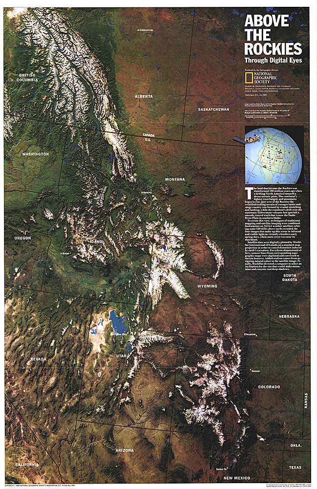
- NOAA satellite imaging formed the basis of this fascinating map of the Rocky Mountain region which was then computer-enhanced by WorldSat International of Canada. Published in July 1995, this map accompanied the "Heart of the Rockies" tourist map.
- Subtype: Wall Art
- Language: English
- Publication Date: 1995-06-01
- Countries Covered: United States
- MPN: HM19950702
- Folded Size: N/A
- Unfolded Size: 20.25" (W) x 31.25" (H)
- Weight: 16 oz