National Geographic Maps
1996 Federal Lands in the Fifty States
1996 Federal Lands in the Fifty States
Regular price
$29.95 USD
Regular price
Sale price
$29.95 USD
Unit price
per
Shipping calculated at checkout.
Couldn't load pickup availability
- SKU: PODHNG_US_FED_96
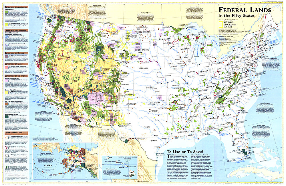
- Considered by many to be the finest map of United States federal lands ever published. This map shows which land areas are controlled by each federal agency, and describes how each land type is managed. Published in October 1996 as a companion to "United States, the Physical Landscape."
- Subtype: Wall Art
- Language: English
- Publication Date: 1996-06-01
- Countries Covered: United States
- MPN: HM19961001
- Folded Size: N/A
- Unfolded Size: 31.25" (W) x 20.25" (H)
- Weight: 16 oz