National Geographic Maps
2006 Earthquakes, Living With the Threat
2006 Earthquakes, Living With the Threat
Regular price
$29.95 USD
Regular price
Sale price
$29.95 USD
Unit price
per
Shipping calculated at checkout.
Couldn't load pickup availability
- SKU: PODHNG_WOR_EQ_06
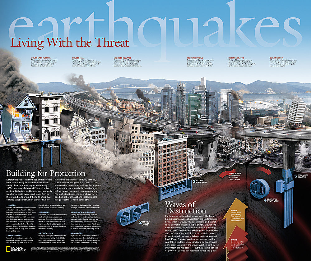
- Published in April 2006 as half of a two-piece set with "Danger Zones: Earthquake Risk, A Global View," this remarkable poster demonstrates the damage done to buildings, highways, high-rises, and other structures within a city when plates shift. It also reveals how strict construction standards and new innovations help hold things together when earthquakes strike.
- Subtype: Wall Art
- Language: English
- Publication Date: 2006-06-01
- Regions Covered: World
- MPN: HM20060402
- Folded Size: N/A
- Unfolded Size: 24" (W) x 20.25" (H)
- Weight: 16 oz